


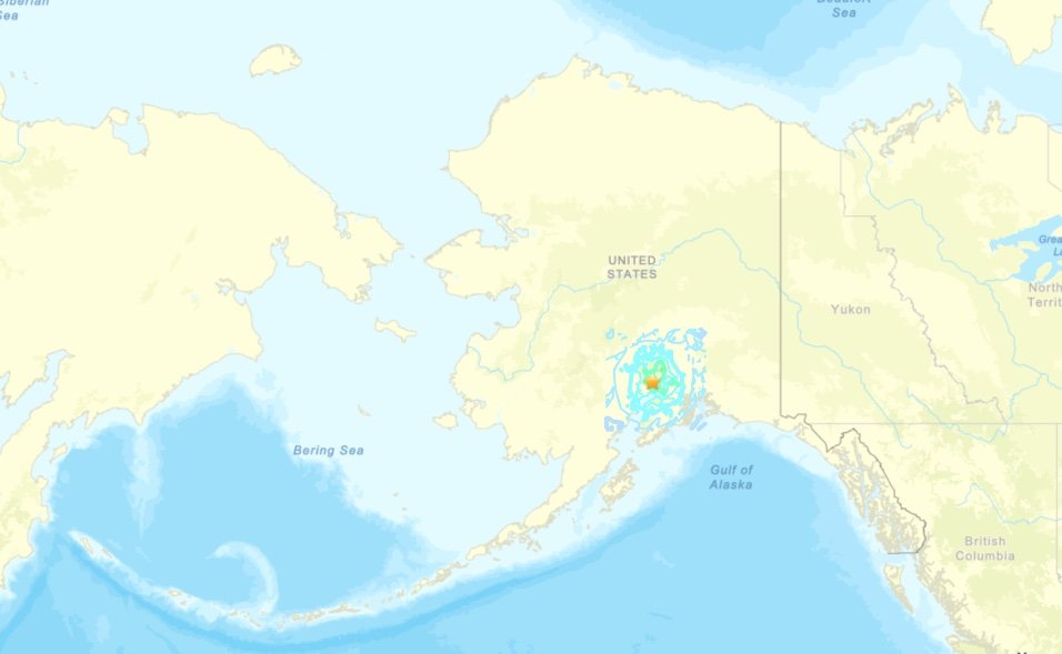
A significant 6.0-magnitude earthquake jolted Alaska’s Anchorage metropolitan area early Thursday morning, marking the most powerful seismic event to hit the region since 2021, according to the U.S. Geological Survey.

The substantial tremor struck at approximately 8:11 a.m. local time, originating from a depth of 69 kilometers (43 miles) beneath the earth’s surface. USGS data pinpointed the earthquake’s epicenter 12 kilometers (7 miles) west-northwest of Susitna, Alaska—a location situated roughly 67 miles northwest of Anchorage proper.
Despite the earthquake’s considerable magnitude, initial reports indicated no immediate signs of significant structural damage or casualties in the affected areas. The relatively deep origin of the quake may have helped minimize surface-level destruction, though seismologists continue to monitor the situation for any developing aftershocks.
Alaska sits within one of the world’s most seismically active regions, positioned along the volatile Pacific Ring of Fire where tectonic plates frequently shift and collide. The state regularly experiences earthquakes of varying intensities, though a 6.0-magnitude event represents a notable occurrence that residents across the Anchorage area would have distinctly felt.
The earthquake serves as a reminder of Alaska’s geological volatility, where major seismic events have historically shaped both the landscape and the preparedness protocols of local communities. Emergency management officials continue to assess the full scope of the earthquake’s impact across the broader metropolitan region.
This latest seismic activity underscores the ongoing importance of earthquake preparedness measures for Alaska residents, particularly those living in the Anchorage area where the majority of the state’s population resides. Local authorities encourage residents to review their emergency plans and ensure they have adequate supplies in case of future seismic events.


